-40%
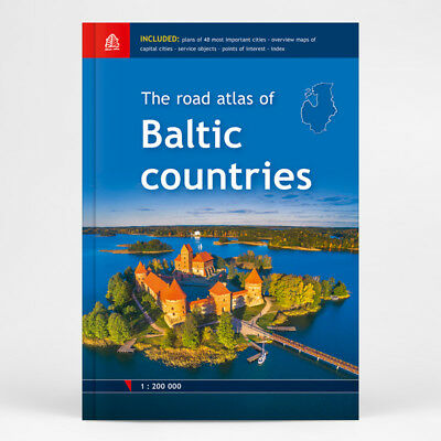
The Road Atlas of BALTIC COUNTRIES, 1:200 000, ed. 2018
$ 17.94
- Description
- Size Guide
Description
First edition! 1:200 000City and town plans in scale 1:20 000
Size 21 x 31 cm, 254 pages, HARDBACK
Jana Seta Map Publishers Ltd., 2018
For the first time the road atlas of the Baltic countries is published at scale 1: 200 000. It is the most detailed map atlas covering the entire territory of the Baltic States. Atlas has a new, larger format and a hardback cover.
Atlas basemap is supplemented with plans of the 48 largest cities at scale 1: 20 000 as well as Tallinn, Riga and Vilnius vicinity maps at scale 1: 85 000. The reader will find the Baltic Sea region map in the introduction section, and place name index in the final section.
For travellers information about points of interest and tourism services will be useful.
Map legend in Estonian, Latvian, Lithuanian, English, German and Russian language.
For buying at least two different items, there is an opportunity to ask for a shipping discount.
It's possible
to
combine orders from
me
and
seller
'UrsansDD' to get a shipping discount. Sellers are different, but sender is the same - Jana Seta Map Shop Ltd.
